|
|
||||||||||||||||||||||||||||||||||||||||||||||||||||||||||||||||||||||||||||||||||||||||||||||||||||||||||||||||||||||||||||||||||||||||||||||||||||||
|
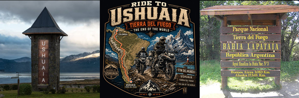
Ride To Ushuaia & Tierra del Fuego & The End Of The World |
||||||||||||||||||||||||||||||||||||||||||||||||||||||||||||||||||||||||||||||||||||||||||||||||||||||||||||||||||||||||||||||||||||||||||||||||||||||
|
Part Of The "Bad As You Want To Be" Series |
||||||||||||||||||||||||||||||||||||||||||||||||||||||||||||||||||||||||||||||||||||||||||||||||||||||||||||||||||||||||||||||||||||||||||||||||||||||
|
|
||||||||||||||||||||||||||||||||||||||||||||||||||||||||||||||||||||||||||||||||||||||||||||||||||||||||||||||||||||||||||||||||||||||||||||||||||||||
|
||||||||||||||||||||||||||||||||||||||||||||||||||||||||||||||||||||||||||||||||||||||||||||||||||||||||||||||||||||||||||||||||||||||||||||||||||||||
|
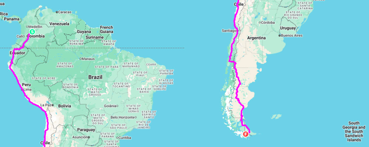
Click On The Above Country Flags To Take You To That Country's Section / Click On Above Map Image For Interactive Google Map Below |
||||||||||||||||||||||||||||||||||||||||||||||||||||||||||||||||||||||||||||||||||||||||||||||||||||||||||||||||||||||||||||||||||||||||||||||||||||||
|
Ride Planning + (GPX File) Planned Itinerary The Gear Spotwalla Tracking Weather |
||||||||||||||||||||||||||||||||||||||||||||||||||||||||||||||||||||||||||||||||||||||||||||||||||||||||||||||||||||||||||||||||||||||||||||||||||||||
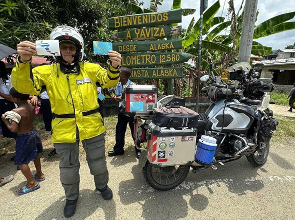
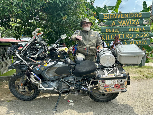
Ride to The End Of The World Planning To Start In Late 2027 Now that Mike and I have ridden to The End of the Road in Yaviza, Panama, where the Darién Gap begins — along with two other epic rides through Central America and Panama, including The Greatest Pizza Run Ever to the Brooklyn Pizza Co. in Guatemala — it is time to begin planning our next major epic adventure: Ushuaia, Tierra del Fuego, and The End of the World. I created this webpage to help us plan and prepare for the ride to Tierra del Fuego. The goal is to make sure everything is handled before we fly into Bogotá, Colombia, pick up the motorcycles, and begin the ride south toward Tierra del Fuego National Park. This page will also serve as a reference for other riders who may be planning a motorcycle ride through South America to Ushuaia. Below you will find detailed information about our plans, proposed country-specific routes, border-crossing requirements, motorcycle documentation, insurance, permits, and other important details needed for a successful ride to The End of the World. Keep checking back here as I will be continuing to add more information about our ride to Tierra del Fuego as it gets closer. |
||||||||||||||||||||||||||||||||||||||||||||||||||||||||||||||||||||||||||||||||||||||||||||||||||||||||||||||||||||||||||||||||||||||||||||||||||||||
|
||||||||||||||||||||||||||||||||||||||||||||||||||||||||||||||||||||||||||||||||||||||||||||||||||||||||||||||||||||||||||||||||||||||||||||||||||||||
|
I have wanted to ride to Ushuaia and Tierra del Fuego for many years. In fact, I have been thinking about and planning this ride for more than five years. This has been a major dream ride for me, and now that I have ridden to The End of the Road in Yaviza, Panama, it is time to ride to The End of the World. I have also convinced Mike that this is going to be a great adventure, and he is now fully on board. We will both be making the ride on big adventure motorcycles — BMW GS Adventures. Our main goal is simple: ride to Ushuaia, Argentina, the southernmost city in the world, and continue on to Tierra del Fuego. We do not have a long sightseeing agenda or a list of major tourist stops. That said, we will stop at interesting places along the route as time allows. This ride will be different from the way many people approach South America. Mike and I both still work full time, so we do not have several months available to slowly travel through each country. Because of that, we are planning a fast and focused ride south, followed by a ride north to Buenos Aires, where we will ship the motorcycles back to the United States. Our daily ride plan is aggressive, and that is one of the main reasons I am working through the logistics now. Once we arrive in Bogotá, Colombia, we want to be ready to ride hard, ride far, and keep moving south. I know many riders say you need a couple of months to properly ride to Ushuaia. We understand that, but we do not have that kind of time. We still want to reach our goal and ride to The End of the World. This will not be our first experience riding south of the U.S. border. Mike and I have a lot of experience riding in Mexico, Central America, and Panama, including riding all the way to The End of the Road in Yaviza, where the Darién Gap begins. I have ridden more than 25,000 miles south of the Mexico border, and Mike and I have twice ridden from Texas to Panama in less than 78 hours — 3 days and 6 hours. We understand the challenges of long-distance international motorcycle travel, border crossings, changing road conditions, and the need to keep moving. One of the biggest logistical challenges of this ride is getting the motorcycles to South America. It is also one of the most expensive parts of the trip. There are several options. The first option is to fly the motorcycles from Miami, Florida, to Colombia as air freight. This is the fastest option, but it is also very expensive at approximately $3,400 per motorcycle. The second option is to ship the motorcycles by sea. This is much cheaper, at approximately $1,500 per motorcycle, but there is no guaranteed arrival date. Clearing customs in Cartagena, Colombia, can also take several days and may become a difficult process. The third option is to ride to Panama City, Panama, and ship the motorcycles from there to Bogotá, Colombia. This option costs approximately $1,000 per motorcycle. At this point, we have decided to ride to Panama and ship the motorcycles from there. This will add about seven days to the overall trip, but the savings are significant — around $2,400 per motorcycle, or approximately $4,800 total between the two of us. That savings is more than we expect to spend together riding from Bogotá, Colombia, to Ushuaia and Tierra del Fuego, and then on to Buenos Aires, Argentina. Because of that, riding to Panama and shipping from there currently makes the most sense for us. I will continue to update this page as we gather more information, finalize the logistics, or make any changes to the plan. Shipping Motorcycle To Colombia I have been researching the best way to get our motorcycles to Colombia, and my first choice has been to fly them from Miami, Florida, to Bogotá, Colombia. Air freight is the fastest and simplest option, but the cost keeps increasing the longer we wait. I am trying to keep the overall expense of the trip under control so I can make the ride happen. Another option is for us to ride our motorcycles to Panama City, Panama, and ship them from there to Colombia. The cost from Panama is much more reasonable at approximately $1,000 per motorcycle. This option would save us about $2,400 per motorcycle, which is a significant amount of money. The tradeoff is time. Riding to Panama City would add approximately seven days to the trip before we even begin the South America portion of the ride. At this point, the Panama shipping option is looking more attractive because of the savings, but we still need to balance the lower cost against the extra time required to get the motorcycles there. Companies That Ship By Airfreight From USA Or Panama To Colombia Or Back To The USA
Our current planned route is approximately 8,000 miles, starting in Bogotá, Colombia, and ending in Buenos Aires, Argentina. From Bogotá, our route will take us south through several major cities in South America, including Quito, Lima, and Santiago, before continuing toward Ushuaia and Tierra del Fuego. We do not currently plan to ride through Venezuela. While conditions may be improving in some areas, we still consider it too risky for this ride and not necessary for reaching our goal. One possible addition to the route is Bolivia. If time allows, we may ride into Bolivia and continue as far as La Paz, which sits at roughly 3,650 meters / 11,975 feet above sea level and is often recognized as the world’s highest national administrative capital. From La Paz, we would turn back toward the main southbound route, rejoin the Pan-American Highway corridor, enter Chile, and continue south. The Pan-American Highway network runs through Colombia, Ecuador, Peru, Chile, and Argentina, with the South American section ultimately reaching toward Ushuaia. Adding Bolivia would increase the ride by approximately 400 miles and likely add at least one extra day to the schedule. If we include that detour, the total planned ride would be closer to 8,400 miles. For now, the primary route remains focused and direct: Bogotá to Ushuaia, then north to Buenos Aires. The goal is not to see everything in South America, but to ride efficiently, safely, and successfully to The End of the World. Plans To Stay Safe And Prepared As part of our preparation for the ride to Ushuaia, Tierra del Fuego, and The End of the World, we will be registering our trip with the U.S. State Department Smart Traveler Enrollment Program, commonly known as STEP. STEP allows U.S. citizens traveling abroad to register their trip with the nearest U.S. Embassy or Consulate. This helps the State Department provide important safety updates, travel alerts, and country-specific information while we are on the road. Registering with STEP also makes it easier for the U.S. Embassy to contact us in the event of an emergency, such as a natural disaster, civil unrest, border closure, or other serious situation. It can also help family and friends reach us if there is an emergency back home. For a ride that will take us through multiple countries in South America, STEP is an important part of our safety and communication plan. It gives us one more layer of preparedness as we work our way south toward Tierra del Fuego. Medical Transport and Emergency Support For this ride, we will have Medjet medical transport coverage, which provides hospital-to-hospital medical transportation by air ambulance or other appropriate means if a serious medical situation occurs while traveling. We also have the motorcycle return-shipping option, which can help get my motorcycle back home if I am medically transported and unable to continue the ride. For the South America ride, I am upgrading my Medjet coverage to MedjetHorizon — what I jokingly call “Medjet Black”. This upgraded level of service includes additional travel security and crisis response benefits powered by FocusPoint International, a company that specializes in security, crisis management, and emergency response support. Those additional services give both my wife and me a little more peace of mind. Hopefully, I will never need any of it, but on a ride through multiple countries, remote areas, border crossings, large cities, and long stretches of unfamiliar roads, having that extra layer of support is worth it. The goal is simple: be prepared, reduce unnecessary risk, and make sure there is a plan in place if something serious happens while we are far from home. This is the current planned cities along my route of course things can change depending on fuel range, border crossings and other types of incidents. An interactive Google map of my route is below is below.
Bad As You Want To Be - End Of the Road - Yaviza, Panama Motorcycle Preparation for the Ride to the End of the World For our upcoming ride to Ushuaia, Tierra del Fuego — The End of the World, I will once again be riding my 2024 BMW R1250 GSA. This is the same motorcycle I rode on our last major ride to Central America and The End of the Road in Yaviza, Panama, where the Darién Gap begins. That ride was approximately 9,000 miles round trip from Fort Lauderdale, Florida, and the GSA proved to be an excellent choice. Its all-around capability, comfort, range, suspension, and ability to handle changing road conditions made it the right motorcycle for that type of ride. I had no issues with the bike, and it performed extremely well from start to finish. For the Tierra del Fuego ride, we will be starting in Bogotá, Colombia, and riding south through South America. The route will take us through a wide range of road conditions, terrain, weather, elevations, and long-distance riding days. I believe the GSA is well suited for this ride and gives me the best chance of handling whatever we encounter along the way. In April 2023, I rode approximately 8,100 miles from Fort Lauderdale to Costa Rica and back on my 2023 BMW R1250 RT — yes, an RT. The motorcycle completed the ride without any major issues, even though I rode it more like an adventure bike than a touring bike. However, the RT was not the ideal motorcycle for that type of ride. Its limited suspension travel and lower ground clearance made it less suited for rough roads, construction zones, unexpected obstacles, and the type of riding that often comes with long-distance travel through Central America. On my first ride to Panama and the Panama Canal in April 2022, I rode approximately 8,700 miles round trip from Fort Lauderdale on my 2019 BMW R1250 GSA. Other than a flat rear tire in Guatemala, that GSA also performed extremely well and confirmed why the BMW GSA is such a strong choice for long-distance international motorcycle travel. Over the years, I have made several modifications to my motorcycles to help me ride farther, longer, safer, and more comfortably. These upgrades are not just about convenience. They help reduce fatigue, improve visibility, increase carrying capacity, support navigation, and make the motorcycle better prepared for long days in remote areas. Those improvements make me a better long-distance endurance rider, and many of them will be especially useful on the ride to Tierra del Fuego. My motorcycle will be well prepared before we start this ride. I do not expect any motorcycle-related issues, but preparation is a major part of completing a ride like this successfully. Prior to departure, the bike will receive a full maintenance service, including a valve check, drive shaft spline inspection, fluid checks, tire inspection, brake inspection, and a complete overall review. For my previous rides to Panama and The End of the Road, I carried many of the tools, spare parts, and support items listed below. This list has grown and improved with each ride, and it will continue to evolve as we prepare for South America. The items below represent what I consider the minimum practical equipment needed to help keep us moving, handle common problems, and get us back on the road if something goes wrong.
Tires Tires For this ride, I plan to run a Dunlop Trailmax Mission rear tire. My goal is to use a rear tire that is durable, reliable, and capable of getting the most mileage possible. I normally get around 10,000+ miles from a motorcycle rear tire, but I know several riders who have gotten 15,000+ miles from the Dunlop Trailmax Mission. Hopefully, that will allow me to complete the ride without needing a rear tire change along the way. On the front, I normally get around 12,000+ miles, so I should be in good shape there as well. Tires are one of the most important parts of a ride like this, so starting with a proven long-mileage setup is a key part of the plan. Electronics and Navigation I have a lot of electronics on the motorcycle that help keep me informed, aware, connected, and headed in the right direction. This includes multiple GPS units, weather information, weather radar, a radar detector, a night vision thermal camera, satellite tracking, phones, cameras, and other support electronics. With that much information coming from different devices, I use an audio mixer system to route the important alerts and navigation prompts into my helmet. I do not want to take my eyes off the road to look at screens if I can hear the information clearly while riding. For navigation, I have multiple Garmin GPS units mounted on the motorcycle, including a Garmin Zumo XT2 and a CarPlay Carpuride 702BS. They are mounted on the handlebar and on the crossbar behind the windscreen. My Garmin GPS is loaded with Garmin South America maps. Riders can also use free Garmin-compatible maps from OpenStreetMap. I will also run Google Maps on my Verizon cell phone, which is mounted on the left handlebar. In addition, I carry a backup phone on Google Fi, which gives me another option for service while traveling through Central and South America. Between Google Maps, two Garmin GPS units, paper notes, and route planning before the ride, I should have enough navigation backup to stay on course. I also have a SPOT 4 satellite tracking device mounted on the dash. It will update my location approximately every five minutes through my Spotwalla tracking map. When I stop at border crossings, hotels, gas stops, or other important locations, I will also send a SPOT “OK” message to mark those points. For video, I plan to use my Insta360 and GoPro cameras to capture as much of the ride as possible. I hope to record the roads, towns, scenery, border crossings, and other parts of the trip that may be helpful or interesting to share later. I especially want to remember to record the border-crossing process whenever possible so future riders can benefit from seeing what to expect. Auxiliary Lights and Auxiliary Fuel Tank I have installed Clearwater auxiliary lights on the motorcycle. These lights provide a tremendous amount of light when riding at night and also make the motorcycle much more visible during the day. I also have a set of Ruby R7 auxiliary lights mounted to add more down the road light. Conspicuity is important on a ride like this, especially when riding through cities, mountains, construction zones, bad weather, and long rural stretches. I also have a 4-gallon auxiliary fuel tank mounted over the passenger seat. Combined with the factory tank, this gives me approximately 12 gallons of total fuel capacity and should provide a range of 400+ miles. When I rode to the Panama Canal and The End Of The Road, I had no problem finding fuel. From what I have read and heard from other riders, fuel availability should generally be manageable in South America as well. Even so, I am identifying fuel stations in each country along the route, especially near border crossings and longer remote sections. I have also been using Google Maps and Street View to verify fuel locations where possible. Having the extra range does not mean I plan to skip fuel stops. It simply gives me more flexibility and a larger safety margin if a gas station is closed, out of fuel, hard to find, or farther away than expected. Other Gear and Storage I use Aerostich tank panniers mounted low on the motorcycle. On the left passenger foot peg, I carry tools and supplies. On the right passenger foot peg, I have a one-gallon water jug mounted with a Garauld hydration system mount. The one-gallon water jug usually lasts me about 20 hours and keeps the water cold for about the same amount of time. Carrying tools, supplies, and water low on the motorcycle helps keep the center of gravity lower, which is important on a fully loaded adventure bike. I also use a large SW-Motech tank bag to carry items I need quick access to while riding, including snacks, electronics, and other small essentials. Inside the tank bag, I have a protected electronics box and a fairly elaborate audio mixer setup that combines audio from multiple devices, including my Carpuride 702BS CarPlay device and radar detector. I will also carry two first aid kits, each stocked with different items. The goal is to be prepared for common injuries, minor medical problems, and unexpected situations that may come up during a long international motorcycle ride. Riding Gear The first thing I put on before any ride is my LDComfort base layer. This is one of the most important parts of my riding gear because it helps keep me comfortable in a wide range of weather conditions, from extreme heat to freezing cold. LDComfort does an excellent job of moving moisture away from the skin and helping me stay dry. I have been wearing LDComfort gear for more than 18 years, and I still have not found anything better for long-distance endurance riding. For outer gear, I wear an Aerostich Darien Hi-Viz jacket and Aerostich AD1 pants. This setup keeps me protected, visible, and dry throughout the ride. It is also comfortable enough for the kind of long riding days where I may not take the gear off for days at a time. For boots, I wear TCX Gore-Tex boots, which keep my feet dry and well protected. Good riding gear matters on a ride like this. Comfort, weather protection, visibility, and safety all become more important when the days are long, the weather changes constantly, and the ride covers thousands of miles across multiple countries. How To Help Prevent Altitude Sickness Along Ruta 40 Parts of Ruta 40 and nearby routes in northwest Argentina can put you very high, especially around Jujuy, Salta, San Antonio de los Cobres, Abra del Acay, Cachi, and the Puna. The risk goes way up when sleeping above about 8,000–9,000 feet / 2,400–2,750 m, especially if you came from low elevation recently. The CDC recommends avoiding going directly from low elevation to a sleeping altitude over 9,000 ft / 2,750 m in one day when possible. Once above that, increase sleeping elevation by no more than about 1,600 ft / 500 m per day, with an acclimatization day every 3,300 ft / 1,000 m gained. Best Plan Riding Ruta 40 1. Build in one or two acclimatization days
before the highest northern sections. 2. Ride high, sleep lower when possible. 3. Keep the first 48 hours at altitude easy. 4. Hydrate, but don’t overdo it. 5. Eat light and keep carbs available. 6. Consider acetazolamide/Diamox before the
trip. Do not start it for the first time in the middle of nowhere if you have never taken it before; discuss allergies, kidney issues, other medications, and side effects with your doctor. Warning Signs: Do Not “Ride Through It” Mild altitude sickness often feels like a hangover: headache, nausea, dizziness, fatigue, poor sleep, loss of appetite. If symptoms are getting worse, the correct move is usually stop ascending and rest. More Serious Danger Signs Include
Ushuaia & Tierra del Fuego Ride Planning I started planning this ride years ago as part of a larger goal: to ride from Alaska to Tierra del Fuego. Because of work and limited time, I have had to break that dream into multiple rides instead of doing it all at once. I rode to northern Alaska in the summer of 2012. I rode to Panama in April 2022 and again in March 2025, reaching The End of the Road in Yaviza, where the Darién Gap begins. Now the next step is to complete the southern portion of the ride by riding to Ushuaia and Tierra del Fuego — The End of the World. Over the years, I have collected a lot of information to help make this ride successful. This page is part of that planning process. It includes notes, routes, requirements, lessons learned, and resources that may also help other riders who are interested in riding through South America to Tierra del Fuego. After completing multiple rides to Panama without any major problems, it became a little easier to convince my wife that riding to Tierra del Fuego could be done safely with the right planning, preparation, and judgment. It still took some convincing, but the experience from previous rides helped prove that I understand what is involved and that I take the risks seriously. Before heading south, riders should review the latest U.S. State Department Travel Advisories for each country on the route. These advisories provide country-specific safety information, entry and exit guidance, local law updates, transportation warnings, and other important travel details. The State Department’s travel advisory map is updated daily, so it should be checked before departure and monitored during the ride. As of my May 2026 planning review, COVID-19 entry restrictions no longer appear to be a major issue for the South American countries on this route. However, entry requirements can change without much notice, so riders should always verify current rules with official government sources, airlines, border agencies, and recent traveler reports before entering each country. For most tourists and temporary motorcycle imports, border fees are generally low or minimal, and many temporary import permits and immigration entries are free or inexpensive. That said, riders should still expect small administrative costs for photocopies, insurance, forms, transportation, or local processing requirements. Border rules can change, so it is important to check official sources, recent rider reports, and tools such as iOverlander before each crossing. Arriving early, staying patient, and being polite can make a major difference. Another important item to understand is SOAT, which stands for Seguro Obligatorio de Accidentes de Tránsito. SOAT is mandatory traffic accident insurance in certain South American countries, including Colombia and Peru. It generally provides medical and bodily injury coverage for people involved in a traffic accident, such as drivers, passengers, pedestrians, and other victims, regardless of fault. SOAT is NOT full motorcycle insurance. It does not normally cover damage to your own motorcycle, damage to another vehicle, theft, property damage, or comprehensive losses. For that type of coverage, riders would need separate liability, collision, theft, or comprehensive insurance where available. The main takeaway is simple: the ride to Tierra del Fuego is absolutely possible, but it requires serious planning. The more information we can gather before the ride, the better prepared we will be when we reach each border, each country, and each long riding day on the way to The End of the World. Two Options To Ship Motorcycles Back To USA Ride to Buenos Aires, Argentina and ship by airfreight to USA, $2,600, or ride to Punta Arenas, Chile and ship from there, $3,250. Riding to Buenos Aires is 2,000 miles and will take about four days to get to the airport hotel to get the motorcycles prepared for shipping. This option is about $500 cheaper than riding to Punta Arenas, 300 miles, and shipping from there. If you ship from Punta Arenas the motorcycles are loaded on a truck and driven to either Santiago, Chile or Buenos Aires, Argentina to be airfreighted back to the USA. If you ship from Punta Arenas it will save three days of riding which would give us more time in Ushuaia & Tierra del Fuego. Also the option of shipping from Punta Arenas saves gas and hotel cost. Which Countries Is SOAT Required? Colombia: Strongly mandatory for all vehicles on public roads (including foreign-plated ones). Police check it frequently. Peru: Mandatory for all vehicles, including foreign ones. Very important — driving without it can lead to fines and vehicle immobilization. Other countries: Not called SOAT or not required in the same way. Ecuador generally has no mandatory insurance requirement for foreign vehicles (and it's hard/impossible to buy local coverage). Some southern countries (e.g., Argentina, Chile, Brazil) use different systems like SOAP, Mercosur insurance, or Carta Verde for third-party coverage. List Of REQUIRED Items For Riding In South America
All of the countries have some fees you have to pay to enter the country. They are not expensive but they do add up. Some are less but I think it is better to be prepared so I can shorten the time it takes to complete a border crossing. Ecuador ‘s requirements for visas and border crossings are among the easiest in South America. Generally, the whole continent is relatively easy to travel in: for US citizens, the only two countries that require visa fees are Bolivia and Brazil. Colombia, Ecuador, Peru, Chile, and Argentina are visa-free for 90 to 180 days depending on the country I am going to arrange to have local currency for each country so I can pay the fees at border crossings. Many banks will do this for you if you give them about a weeks notice. Also there are some online companies that sell foreign currency and mail it to your house. I am going to try and NOT use any border helpers as I have heard that it only makes it harder for travelers who are following you. Also you never know what will happen to your paper work. Here are the current border crossings I plan to use and the times they are open. I need to plan my ride to arrive at each border when they are open. I do not want to be hanging around for long periods of time while waiting for the border to open. South America GPX File Download Link:South America Ride GPX File Currently Planned Itinerary - Bogota To Ushuaia / Tierra del Fuego
Insurance requirements in South America
Bottom line: The countries where you should specifically plan for SOAT are Colombia, Peru, and Bolivia. For Chile, buy SOAPEX. For Argentina, Brazil, Paraguay, and Uruguay, plan on Carta Verde / Mercosur third-party insurance. Ecuador is the main exception where foreign vehicles have often not been required to buy local SOAT-style insurance. International Driving Permit For a U.S.-licensed motorcycle rider, I would carry an International Driving Permit for South America. In many countries, your valid U.S. motorcycle endorsement + passport + vehicle documents may be accepted, but the IDP is an official translation and is often useful at police checkpoints, borders, insurance offices, and after an accident. The U.S. government says U.S. travelers should get an IDP through AAA or AATA, the two organizations authorized by the U.S. Department of State.
Below Is Country Specific Information For Each Country Below is specific information that I found for each country while researching for our ride. Each country has there own specific requirements and they may change at any time. What you need at a minimum to ride in Colombia. Border Operations - Banjército Allende/Piedras Negras: 24 Hours Google Map Link To Colombia Customs: Keep TVIP / TIP Open: Yes
The route through Colombia is starting in Bogota. Google Map Link For Route In Colombia - Colombia Route Colombia Border Crossing Fees
I am not sure yet if I am shipping my motorcycle by air or ship so I am not sure where I will be entering Colombia. Either way I will be using an agent to handle all of the customs and immigration requirements including obtaining vehicle insurance ( SOAT ) for my motorcycle. You can speed up the TIP process by uploading your documents here before going to Columbia.
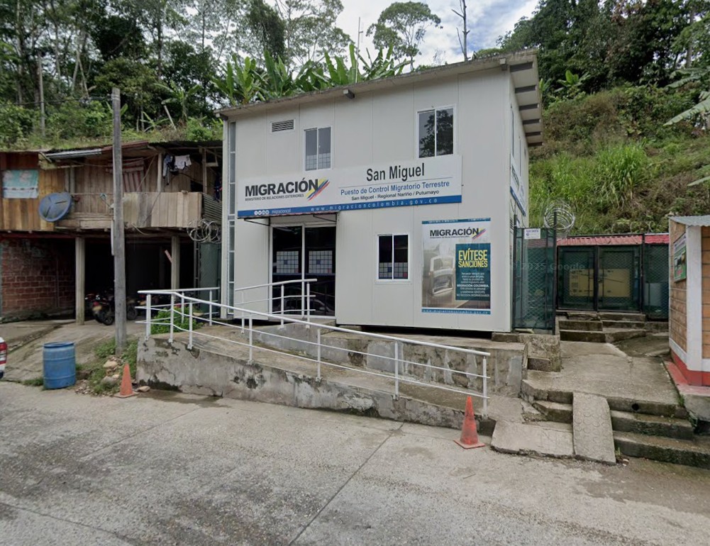
Exiting Colombia Imagration Office On Highway 45
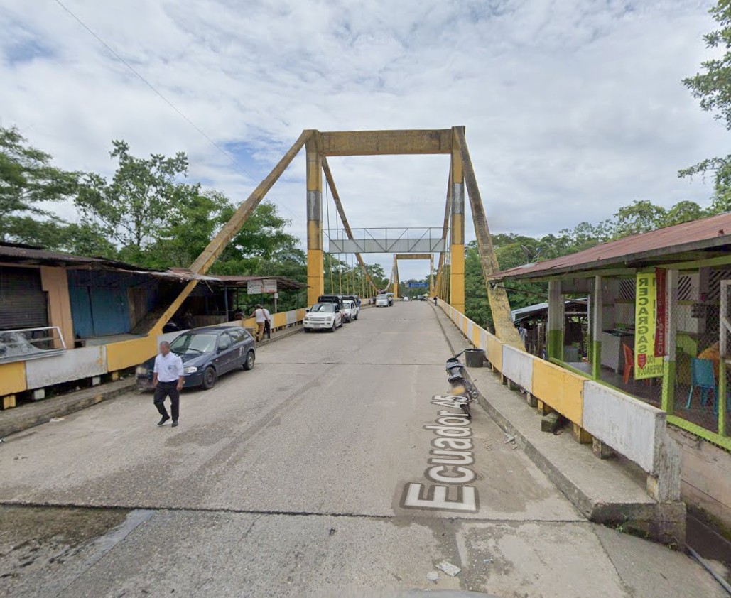
The Bridge Crossing Into Ecuador What you need at a minimum to cross into Ecuador. Border Operations - 24 Hours Google Map Link To Ecuador Customs: Rumichaca International Bridge Keep TVIP / TIP Open: Yes
Google Map Link For Route In Ecuador - Ecuador Route Ecuador Border Crossing Fees
Best practice: Canceling Your Ecuador TIP (Critical for Southbound) Stop at the SENAE customs office about 5 km before the actual border bridge in Huaquillas to cancel the TIP. Many travelers strongly recommend this to avoid having to backtrack if they tell you at the border that it must be done first. facebook.com Hours for TIP cancellation: Daytime business hours are much more reliable (typically 8 AM – 5/6 PM). Late-night or very early attempts often result in having to wait until morning. Step-by-Step Process at Rumichaca (Colombia → Ecuador)Cross the bridge into Ecuador (Tulcán side).
Ecuador ‘s requirements for visas and border crossings are among the easiest in South America. Ecuador has a fairly hassle-free entry system, and even the smaller border posts are usually fast and efficient. Currently there are no costs associated with crossing this border. Exiting Ecuador is pretty easy as entering: get your exit stamp, then go to the aduana office and hand your TVIP in. Normally, the whole process takes about 15 minutes. Ecuador does not require you to buy local ( SOAT ) insurance. Also Ecuador does not require you to have any vaccinations to enter the country except for COVID vaccine. Drive across the bridge from Colombia and take a right. Crossed the main highway and park on the left side of the road near the rock/dirt wall. Go to Migracion which is now on the right inside portion of the building. Once you enter turn to the right and get in the line on the right side of the lobby. I have read and heard that Ecuador is one of the most peaceful and safest countries in South America, but do be careful with your valuables in bigger cities just as you would anywhere else.
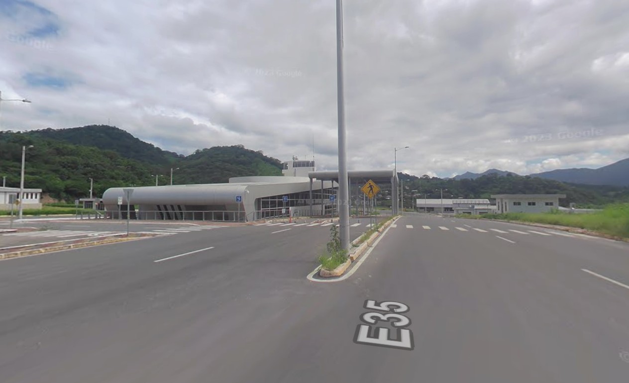
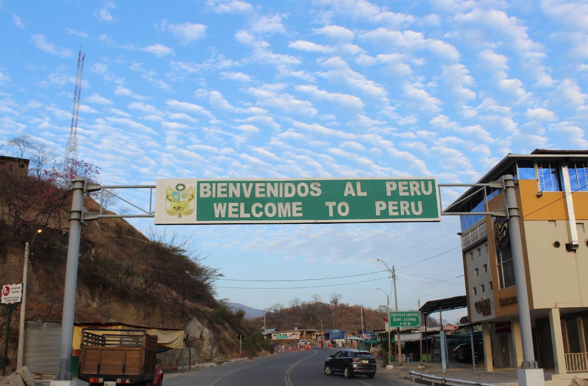
Photo Of The Ecuador Border Crossing - Immigration - Aduana - Google Street View What you need at a minimum to cross into Peru. Border Operations - 24 Hours Google Map Link To Ecuador Customs: Puente Internacional Perú - Ecuador
Google Map Link For Route In Peru - Peru Route
I will be entering Peru at the Macara International Bridge border crossing. Longitudinal Axis PE-1 (Spanish: Eje longitudinal PE-1), commonly known as the Pan-American Highway (Spanish: Carretera Panamericana), is the most important highway in Peru, forming part of the larger Pan-American Highway. It is one of three roads that cross the country from north to south, connecting the country's border with Ecuador with Bolivia and Chile.
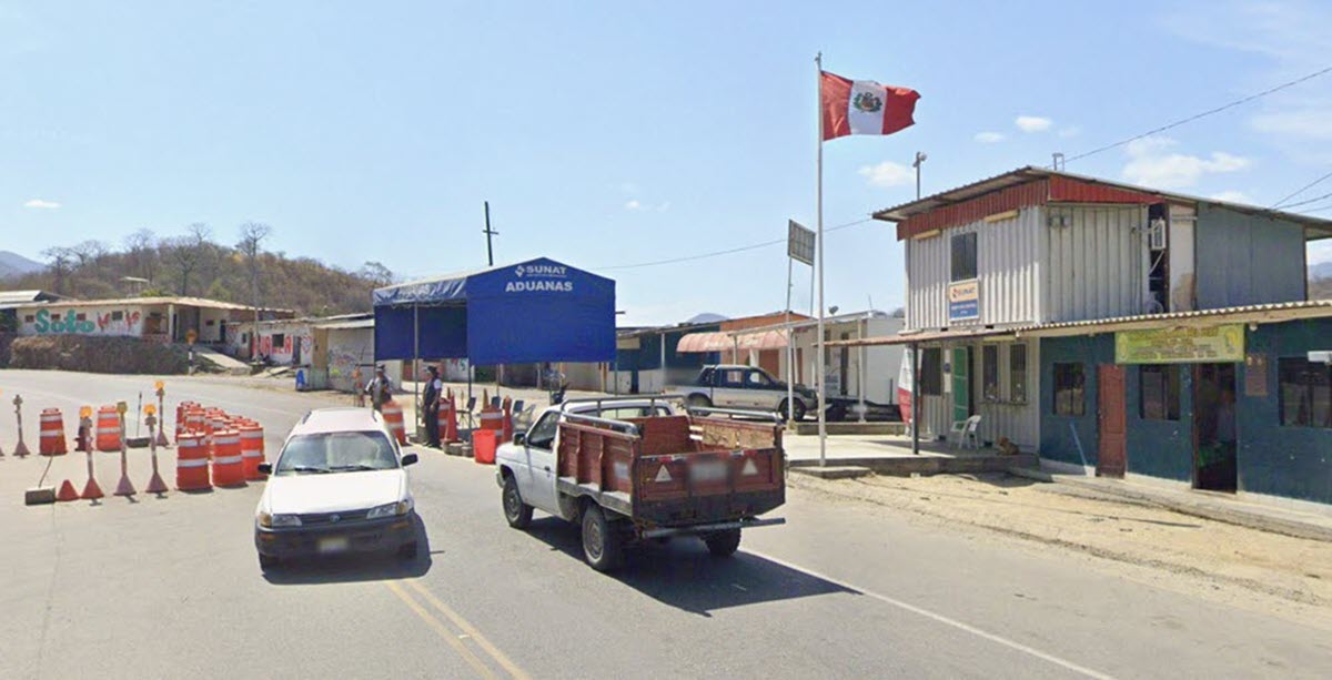
Photo Of The Peru Border Crossing - Google Street View
Peru Immigration - Aduana What you need at a minimum to cross into Bolivia. Border Operations - Bolivia - Chile Border: ??? Google Map Link To Bolivia Customs: Controles integrados BOLIVIA -PERU Keep TVIP / TIP Open: Yes
The route through Bolivia is ??? mile which should be around ??? Google Map Link To Route In Bolivia - TBD Bolivia Border Crossing Fees
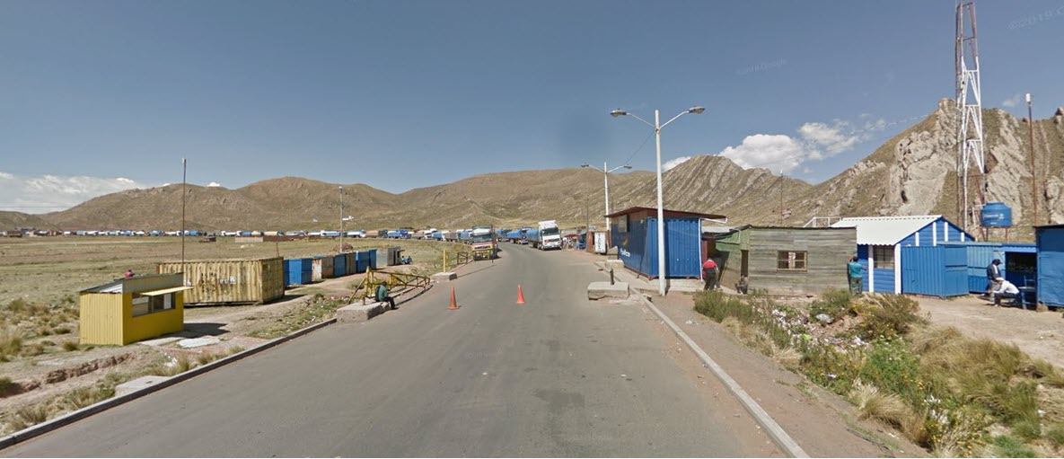
We will be entering Bolivia at the Guaqui, Bolivia Controles integrados BOLIVIA -PERU border crossing.
Photo Of The Bolivia Border Crossing - Google Street View What you need at a minimum to cross into Chile.
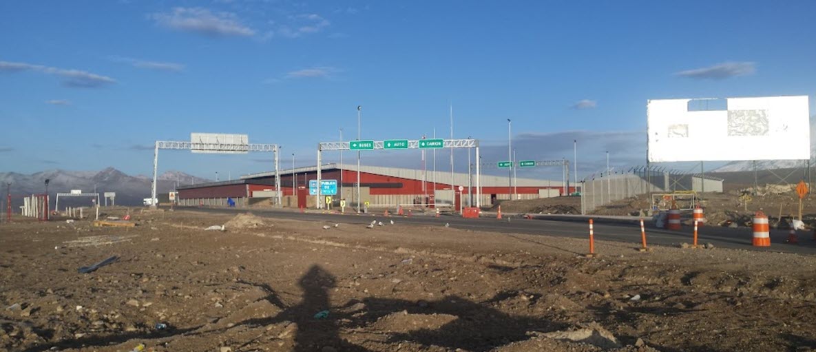
Border Operations - Chacalluta Border Complex Google Map Link For Route In Chile - Chile Route
The Chacalluta Border Complex (connecting Peru and Chile) operates 24 hours a day, 7 days a week, allowing travelers to obtain the Título de Importación Temporal de Vehículos (TITV) or Temporary Import Permit (TIP) at any time. Route 5 is Chile's longest route Part of the Pan-American Highway, Ruta National 5 is said to be Chile's longest route. It's a notoriously dangerous drive filled with deep valleys, steep drops, and desert. How long is Ruta Nacional 5 in Chile? Chile Highway 5, or Route 5, is 3,337 km (2073 miles) long, running north-south from the Peruvian border near Arica (a port city in the northern part of the country) to Quellón (a port city in southern Chiloé Island). Four tunnels are part of Route 5: El Melón, La Calavera I, La Calavera II, and Angostura.
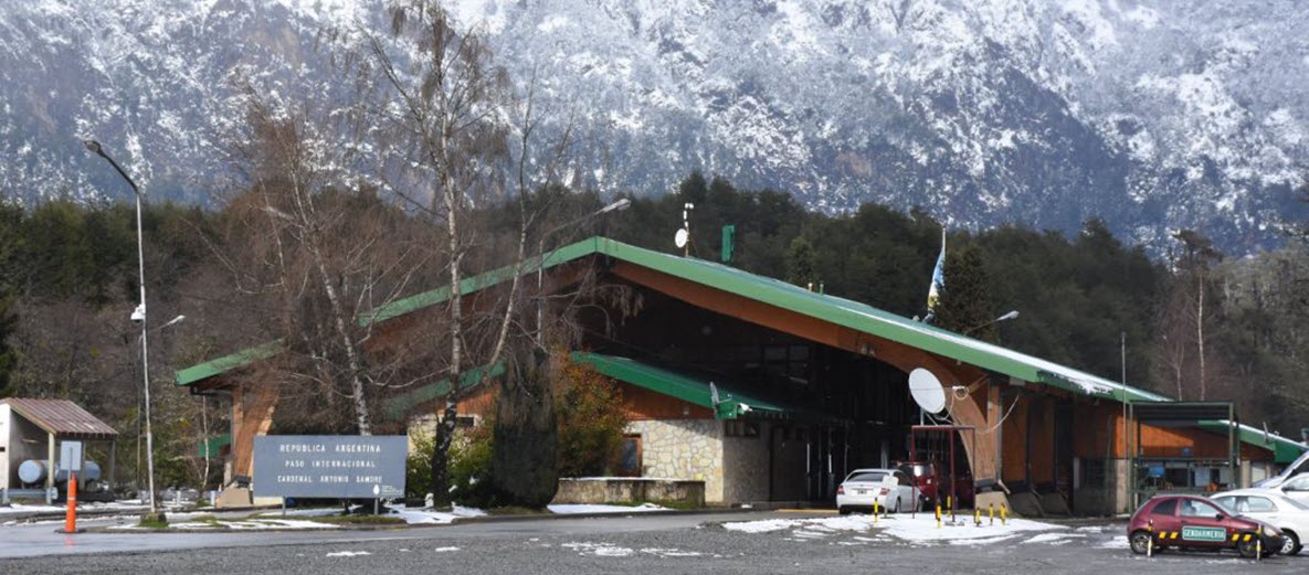
Photo Of The Chile Border Crossing - Google Street View What you need at a minimum to cross into Argentian. Border Operations - ??? Google Map Link To Argentina Customs: Keep TVIP / TIP Open: ???
Important Argentina Land Entry Process - Currently Required The route through Argentina is ??? miles . Google Map Link For Route In Argentina - Argentina Route Google Map Link For Route From Southern Argentina To Ushuaia - Route To Ushuaia Argentina Border Crossing Fees
Photo Of The Argentina Border Crossing - Google Street View I hear ???. Photo Of The Argentina Border Crossing - Google Street View Right now my idea is ??? Roads In Argentina On My Route
Argentina Border Crossing Fees
We have to take a ferry on Highway 257 on thePunta Delgada- Bahía Azul ferry.
|
||||||||||||||||||||||||||||||||||||||||||||||||||||||||||||||||||||||||||||||||||||||||||||||||||||||||||||||||||||||||||||||||||||||||||||||||||||||
|
Interactive Maps Below |
||||||||||||||||||||||||||||||||||||||||||||||||||||||||||||||||||||||||||||||||||||||||||||||||||||||||||||||||||||||||||||||||||||||||||||||||||||||
|
Below are three interactive maps Google route map, Spotwalla tracking map and weather map. Route Map The Google route map and the Spotwalla tracking map allow you to zoom in and out using the + and - buttons in the bottom right of the maps and you can drag the map with a mouse. You can also zoom in and out of the maps with a mouse that has a wheel. They show my planned route ( Google Map ) and below that map is a map of my current location with the use of a SPOT satellite tracking device and Spotwalla.com ( thanks Jason Jonas ). Weather Map Here is a link to my ride to the Tierra del Fuego, Argentina weather webpage with weather for 30 cities along the route and 15 different weather maps. This is a great way for me to see what weather lies ahead on my route. There is a nice interactive weather view at the bottom of the weather webpage. Weather Webpage Link: Spotwalla Tracking Here is my direct Spotwalla tracking links that will open in a new browser window. Also below is my embedded Spotwalla tracking map. I have two SPOT satellite tracking devices and I transmit my location every 5 minutes with both SPOT devices. Spotwalla Tracking Link:
| ||||||||||||||||||||||||||||||||||||||||||||||||||||||||||||||||||||||||||||||||||||||||||||||||||||||||||||||||||||||||||||||||||||||||||||||||||||||